
Advies
Webmapper deelt graag haar kennis en ervaring: van het cartografisch ontwerpen tot het bouwen van interactieve kaartapplicaties, dataplatforms en geografische web-services.
Webmapper creëert interactieve kaartapplicaties. Het bureau biedt oplossingen op het snijvlak van geo-informatie, webtechnologie, cartografie en design. Door locatie en design met elkaar te verbinden maakt Webmapper informatie toegankelijk.
Webmapper deelt graag haar kennis en ervaring: van het cartografisch ontwerpen tot het bouwen van interactieve kaartapplicaties, dataplatforms en geografische web-services.

Webmapper ontwerpt en ontwikkelt creatieve en gebruiksvriendelijke kaartapplicaties op maat.

Webmapper maakt unieke en aansprekende topografische en thematische kaarten die passen bij jouw website.
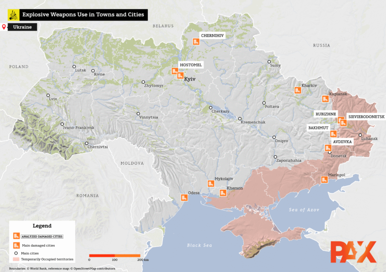
After the Blast identificeert de impact op het milieu als gevolg van het gebruik van explosieve wapens in bevolkte gebieden in Oekraïne.
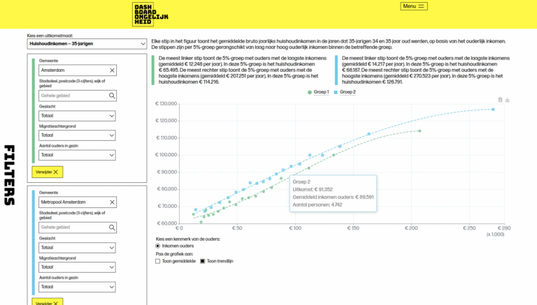
Waar kinderen opgroeien hangt samen met hun kansen in het leven.

Vergroen de wereld en begin in je eigen straat!